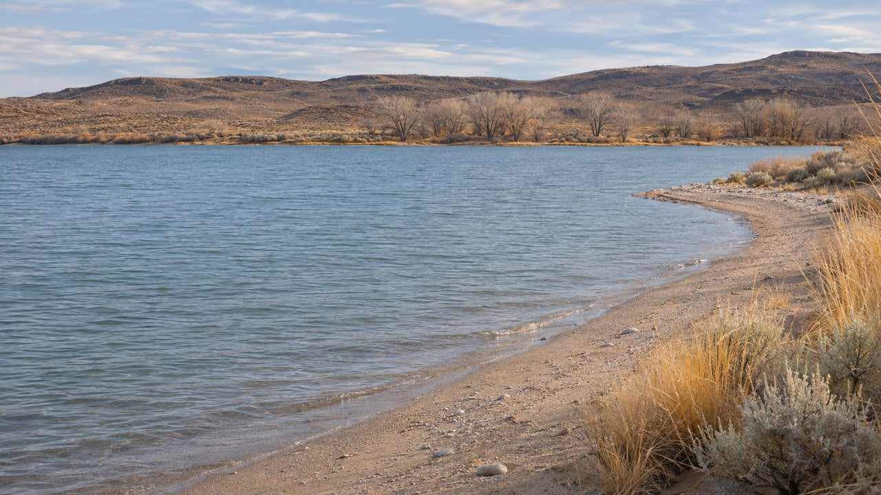
Lahontan Refills After the Boats Come Out. What Silver Springs' Winter Shoreline Looks Like This Year
November 12, 2026
November 12, 2026
On Nov. 8, the federal Water Master's daily report showed Lahontan Reservoir holding 57,192 acre-feet. Early in October, the Truckee-Carson Irrigation District reported 71,952 acre-feet. That works out to a drop of roughly 14,700 acre-feet over about a month, as the last of the season's irrigation water went downstream. By the end of November, the district expects storage to be back near 71,600 acre-feet.
So from the Silver Springs side, the reservoir is at or near its seasonal low, and the refill has already started. The winter months bring the most change to the water itself. The reservoir refills, contractors start work on the dam's outlet works, and duck hunters share the shoreline through January. The stretches of shore where hunting is allowed are fixed by landmarks, so they stay the same however high the water climbs.
In early October, no Truckee Canal diversions into Lahontan were allowed because of storage targets. TCID Water Master Kelly Herwick said at the time that diversions could resume in November or December, depending on conditions. They resumed sooner. The Fallon Post reported that the district began taking more available Truckee River water into the canal on Nov. 2 and planned further increases as other diversions were reduced.
At the board's Nov. 3 meeting, staff put storage at about 57,633 acre-feet, with daily outflows still running about 218 acre-feet ahead of inflows. That gap closes as irrigation deliveries taper off. Nov. 6 was the last day to order water, and the 2026 season is expected to end around Nov. 15. After that, the canal keeps bringing water in and very little goes out. In October, the district projected more than 50,000 acre-feet of carryover into the next water year.
Here are the milestones from early November to spring, as TCID has laid them out:
The dam project is scheduled for winter for the same reason the reservoir refills in winter. Nobody downstream is ordering water. The Fallon Post reported that district crews have been building an access ramp near the existing boat ramp and getting ready to remove trash racks, hydraulic cylinders and other parts so workers can reach the dam's outlet structures.
The work will go in stages, three components at a time, so the district keeps some operating flexibility. Completion is expected by March 15, though weather could push the schedule. In October, the same outlet described the plan as three gates at a time, so water can still be released if conditions call for it. A U.S. Bureau of Reclamation representative said the agency wants to see the project finished before the 2027 irrigation season.
Other winter maintenance is on the district's list as well, including concrete replacement, equipment repairs and getting ready for the seasonal canal shutdown. That means the north end of the reservoir will see crews and equipment for most of the winter, while the water behind the dam keeps rising.
In its hunting boundary descriptions for Lahontan State Recreation Area, the agency writes that "changes in water levels do not alter hunting boundaries." The zones are tied to restrooms, beach numbers and the county line, so they stay in place as the waterline moves.
The Silver Springs beaches run from the park boundary at the Carson River Ranch north to the Lyon-Churchill County line. Within that stretch, the boundaries fall like this:
| Hunting allowed | Hunting not allowed |
|---|---|
| South of the Beach 4 restroom, down to the park boundary at the Carson River Ranch | North of the Beach 4 restroom and south of Beach 11, on both the west and east shores |
| From Beach 11 north to the Lyon-Churchill County line, including Virginia Beach and the wooded area north of Beach 11 on the east side of the railroad tracks | Includes the Silver Springs Boat Ramp, Day Use Area, Beach 3, Fisherman's Point, Cove 3, Cove 5, Beach 5, Developed 7 Campground, Beach 7 and Beach 9 |
That puts the boat ramp, the day-use area and the year-round campground at Beach 7 inside the no-hunting stretch. On the Churchill County side, the park also excludes Lahontan Dam, River Campground, the Overlook, Blackbird Point, North Shore Marina, the Day Use area and Beaches 21 through 30.
The season runs long. Lahontan is in Nevada's Northwest Zone, where the 2026–27 regular duck and merganser season runs Oct. 17, 2026, through Jan. 3, 2027, then reopens Jan. 6 through Jan. 31, according to the current Nevada migratory game bird schedule. Scaup season opened Nov. 5 and uses the same January break. A youth waterfowl hunt is set for Feb. 13, 2027, and a snow and Ross' goose season runs Feb. 22 through March 7, 2027. For most of the winter, then, some hunting season is open at Lahontan from early fall into March.
The park says its administrator can change zone boundaries to protect park resources, and it recommends that hunters confirm the rules with a ranger. The Silver Springs office number is 775-577-2235.
The rest of the park goes onto its winter setup while the water rises. Nevada State Parks' winterization notice, dated Nov. 1, 2026, lists Lahontan's flush restrooms and shower buildings as closed for the winter. Pit toilets stay open, and the agency suggests calling the park before you go. The Lahontan park page lists the developed campground at Silver Springs Beach #7 as open year-round. Day use costs $5 per Nevada vehicle and $10 for out-of-state vehicles. The boat launch is $15 or $20, and camping is $15 or $20 per vehicle per night.
Two advisories still apply to the water. As of a Nov. 2 update, the park's harmful algal bloom status had been lowered from Danger to Warning, but cyanobacteria were still present and the state advisory still says "swim at your own risk." The Nevada Department of Wildlife's 2026 Lahontan angler guide lists the reservoir as open to fishing year-round. It also repeats the agency's recommendation not to eat any fish from Lahontan Reservoir, the Carson River below Dayton or any water in the Lahontan Valley.
This is the season for birds. Nevada State Parks notes that migratory waterfowl, pelicans, herons, egrets and hawks are often seen at Lahontan, and it calls the park one of the few bald eagle nesting sites in Nevada. NDOW's birding page also lists bald eagles and waterfowl as common near the water, and American white pelicans as one of the area's standout species.
A few miles upriver, Fort Churchill State Historic Park is listed as always open. Its Buckland Station Museum is open Saturdays and Sundays from 10 a.m. to 2 p.m., and admission is $1.
Winter on land in Silver Springs has two dates at the same address. The Silver Springs Area Chamber of Commerce holds its last 2026 general meeting on Monday, Nov. 16, at the Silver Springs Senior Center, 2945 Ft. Churchill St. The meeting runs 5:30 to 6 p.m., followed by a holiday mixer with a potluck and raffle from 6 to 7 p.m. On Dec. 12, the Senior Center hosts the Hometown Christmas and Parade of Lights Tree Lighting from 5 to 6:30 p.m. By then, if TCID's projection holds, the reservoir will be back above 70,000 acre-feet, and contractors will be about a month into work at the dam.
This post is general information, not legal advice. Hunting zones, seasons and advisories can change, so check with Nevada State Parks or NDOW before you go.
For many Silver Springs properties, Lahontan's seasons are part of what an address offers, and they help explain why two nearby parcels can feel different to own. If you'd like to talk through how the reservoir figures into a purchase or sale on this side of Lyon County, Samira Khaled is glad to go over the specifics with you. Let's Connect.
Stay up to date on the latest real estate trends.
Your goals deserve focused attention and thoughtful execution. With a boutique-level standard of service, every decision is guided by preparation, market insight, and a commitment to excellence—ensuring a seamless experience from strategy to closing.
308 N. Curry Street, Suite 202 Carson City, NV, 89703